SCARCE GUIDE TO CHINA AND JAPAN
DENNYS, Nicholas Belfield (editor).
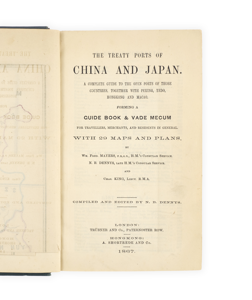
The Treaty Ports of China and Japan. A complete guide to the open ports of those countries, together with Peking, Yedo, Hongkong and Macao. Forming a guide book & vade mecum for travellers, merchants, and residents in general. With 29 maps and plans. By Wm Fred. Mayers … N.B. Dennys … and Chas King … Compiled and edited by N.B. Dennys. London, Trübner and Co.; Hong Kong, A.
Shortrede and Co., 1867.
8vo, pp. viii, [2], 498, [2], 499-668, [2], xlviii, [2], 26, [2]; with 29 partly coloured maps and plans (mostly folding); Chinese characters in text; vertical tear (without loss) to pp. xi-xii, a little toning; very good in recent green cloth, original spine lettered and decorated in gilt laid down, marbled wrappers bound in; a little wear to extremities.
Added to your basket:
The Treaty Ports of China and Japan. A complete guide to the open ports of those countries, together with Peking, Yedo, Hongkong and Macao. Forming a guide book & vade mecum for travellers, merchants, and residents in general. With 29 maps and plans. By Wm Fred. Mayers … N.B. Dennys … and Chas King … Compiled and edited by N.B. Dennys. London, Trübner and Co.; Hong Kong, A.
First edition, complete with all twenty-nine maps and plans, of this remarkable guide to the open ports of China and Japan in the late 1860s, aimed at ‘travellers, merchants, and residents’, compiled by Nicholas Dennys (1839–1900), a noted scholar of Chinese folklore, with the sinologist William Frederick Mayers (1838–1878).
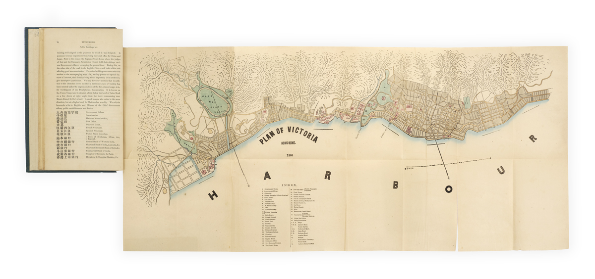
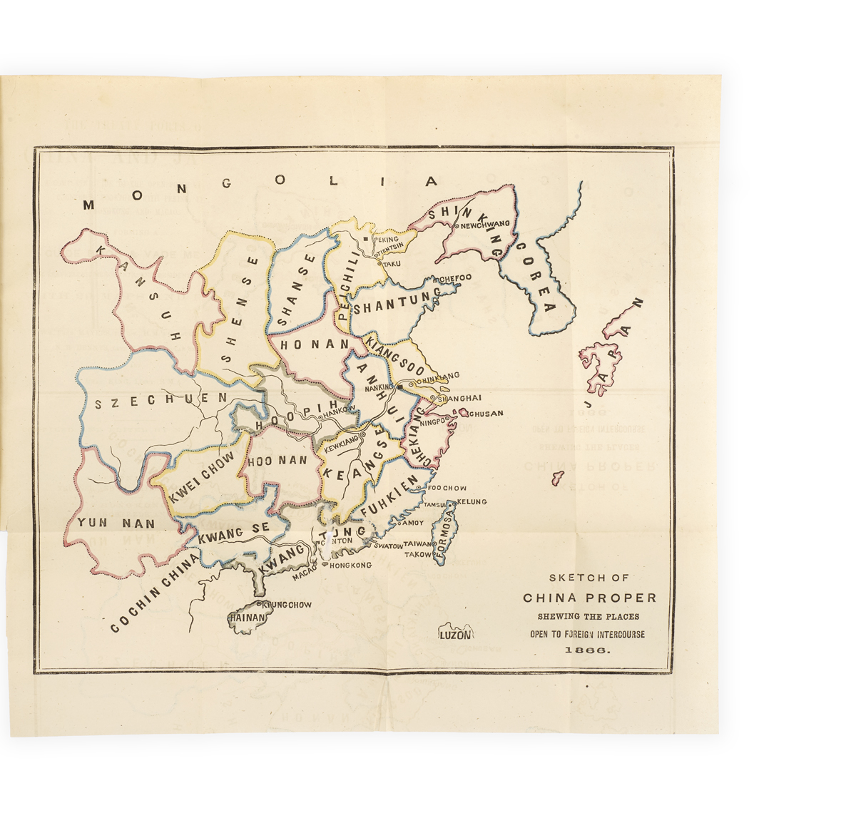
Opening with a ‘sketch of China proper shewing the places open to foreign intercourse 1866’, the volume includes maps and plans of Hong Kong, Guangzhou, Macao, Shantou, Xiamen, Fuzhou, Taiwan, Ningbo, Shanghai, the Yangtze River ports, Tianjin, and Beijing, as well as of Nagasaki, Yokohama, Edo, and Hakodate. The text is extremely thorough, the section on Hong Kong, for example, describing, inter alia, its geography, history (in particular from 1839), public buildings, roads, ‘amusements’, newspapers, population, hotels, market prices, sanitary conditions, botany and geology, police force, and missions. A plate showing ‘Japanese coinage’ appears within the section on Nagasaki. The volume ends with an appendix detailing ‘means of transport between England, France, and America, and China and Japan’, illustrated with a map showing ‘the ocean steam routes of the world’, and with a ‘catalogue of books, &c., on China and Japan’.