CARY, John.
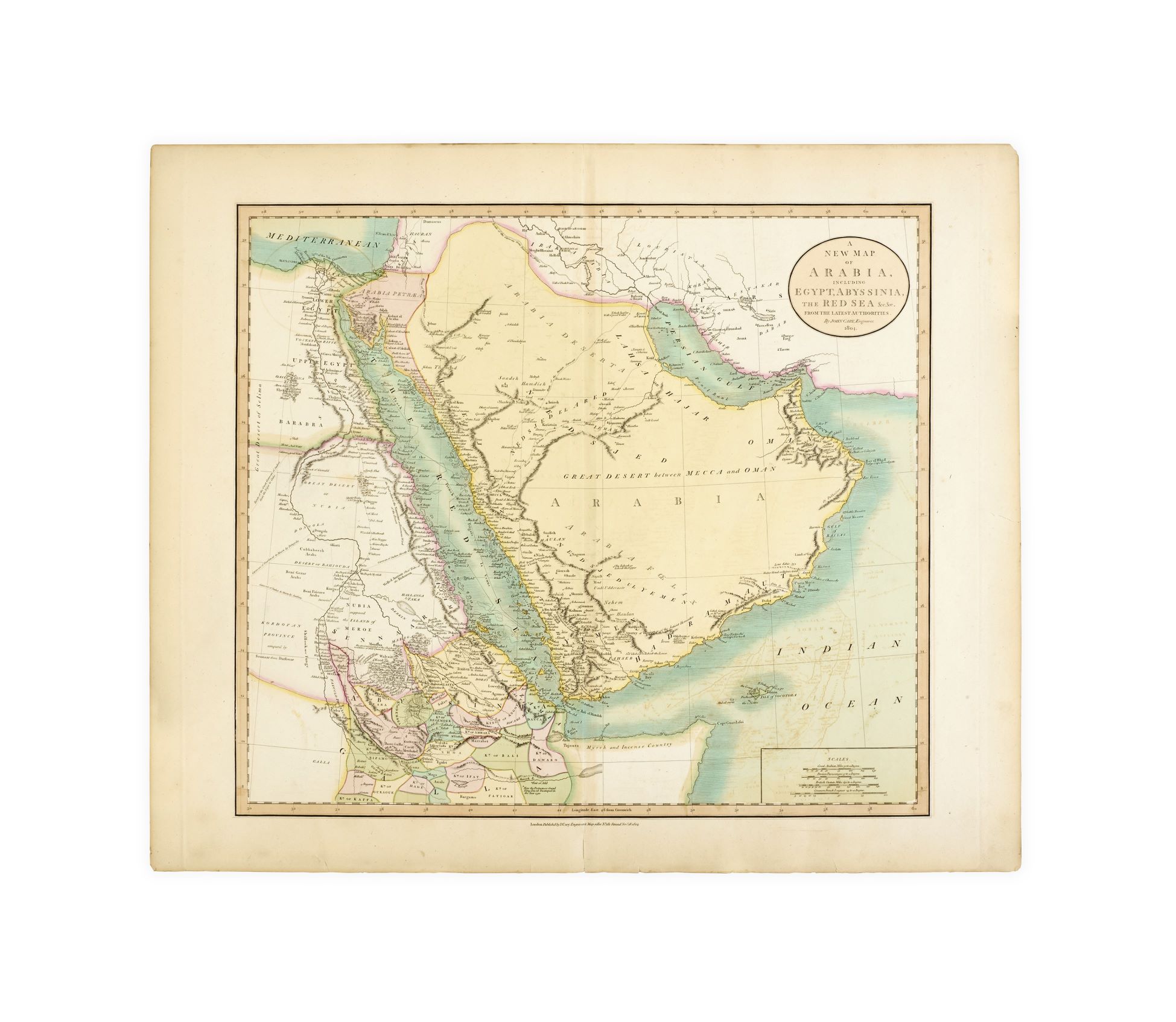
A new map of Arabia, including Egypt, Abyssinia, the Red Sea &c. &c. from the latest authorities. By John Cary, engraver. 1804. London, John Cary, 28 November 1804.
Engraved map (545 x 650 mm, engraved area 460 x 520 mm) with contemporary hand colouring; a little offsetting from folding, some toning, a few small tears to edges; small printed label ‘45’ to back.
Added to your basket:
A new map of Arabia, including Egypt, Abyssinia, the Red Sea &c. &c. from the latest authorities. By John Cary, engraver. 1804.
An attractive hand-coloured map of the Arabian Peninsula and northeast Africa by the English cartographer John Cary (1755–1835), later included in Cary’s New Universal Atlas of 1808.
Cary’s ‘cartographic output was prolific and diverse, ranging through maps, plans, atlases, astronomical and educational works, road-books … guides, and globes’ (ODNB). ‘The quality of his engraving established new standards and a new style, with his effective, starkly beautiful, plain design being widely adopted’ (ibid.).
This New Map features, for example, Alexandria, Cairo, Jerusalem, Gaza, Mount Sinai, Jeddah, Mecca, Aden, Muscat, Baghdad, Babylon, and Persepolis. There is much charming detail: three pyramids at ‘Geeza’; criss-crossing caravan routes; a confidently placed ‘source of the Nile’; a note in the Horn of Africa reading ‘here the Portuguese found King David encamped in the year 1520’. Other captions include ‘fishermens hutts’, ‘tents of Arabs’, ‘myrrh and incense country’, ‘wells of good water’, ‘well of bitter water’, ‘moving sand’, and ‘pirates’.