Livingstone sails down the same river twice
LIVINGSTONE, David and Charles LIVINGSTONE.
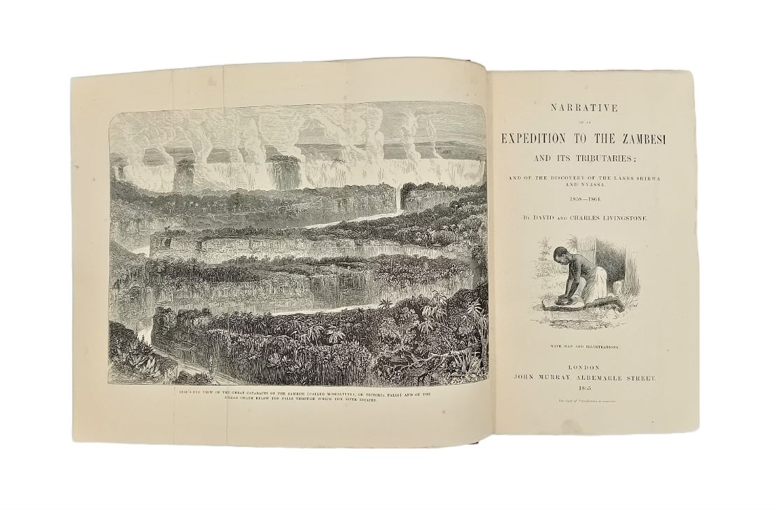
Narrative of an expedition to the Zambesi and its tributaries; and of the discovery of the lakes Shirwa and Nyassa. 1858-1864.
London, John Murray, 1865.
8vo, pp. xiv, [2], 608, 32 (publisher’s catalogue dated January 1865); with folding frontispiece, 12 full-page plates, 21 further illustrations in the text, and 1 folding map; some foxing and spotting throughout, closed tear to folding map crudely repaired to verso; a good copy in original maroon cloth with gilt vignette on upper cover, gilt lettered spine, green endpapers; spine repaired at head and foot (with some loss), hinges repaired, spine and covers faded; ticket ‘Restored by Blair Jeary’ to front pastedown.
Added to your basket:
Narrative of an expedition to the Zambesi and its tributaries; and of the discovery of the lakes Shirwa and Nyassa. 1858-1864.
First edition, by David Livingstone and his brother Charles, recounting Livingstone’s second Zambesi expedition which, despite several important discoveries, was largely regarded as an ignominious failure. In 1857, Livingstone resigned from the London Missionary Society and accepted the position of British Consul at Quilimane; at the same time he agreed to lead an expedition, financed by £5000 from the British Government, to chart the course of the Zambesi and investigate the agricultural potential and natural resources of the region. In private Livingstone had hoped that the expedition would ultimately lead to the founding of an English colony in Central Africa. However, the expedition was plagued by supply problems, internal disputes, sickness (Mary Livingstone died on 27 April 1862), and problems arising from the unsuitability of the steamship; despite reaching Murchison Falls, Lakes Shirwa and Nyassa and the Victoria Falls, further successes proved to be limited and the expedition was eventually curtailed in February 1864.
Alongside numerous illustrations, this copy also contains a large folding map by the notable English cartographer John Arrowsmith (1790-1873).
Gay 3034; Hosken, p. 126; South Africa Bibliography III, p. 137.