THE WORLD IN MAPS
[BELLIN, Jacques-Nicolas].
Collection of maps from Prévost’s Histoire générale des voyages.
Paris, Didot, 1746-1789.
4to, containing 74 maps (many folding) and 1 further folding plate; first map loose, some loss to corner of map 22, some creasing and toning, a few small closed tears; overall very good, bound in quarter mottled calf and mottled paper boards, spine richly gilt in compartments with red morocco lettering-piece, marbled edges; spine a little rubbed, some wear to corners; contemporary manuscript list of contents ‘Table des cartes’ bound in at end.
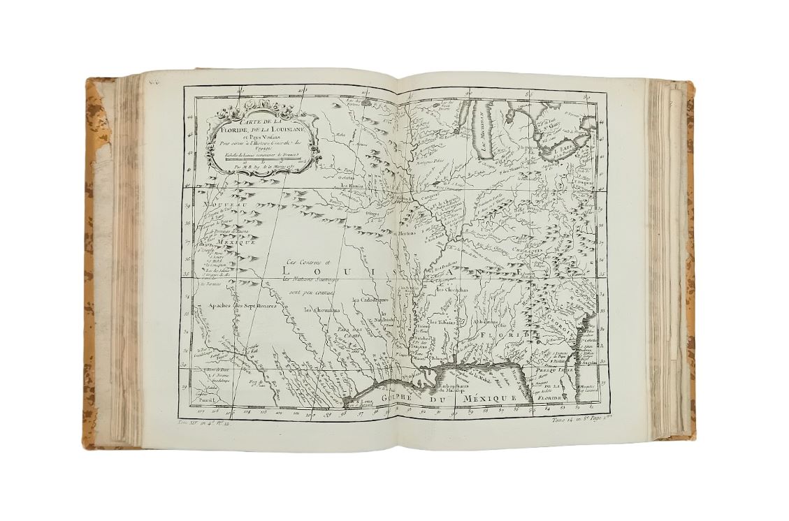
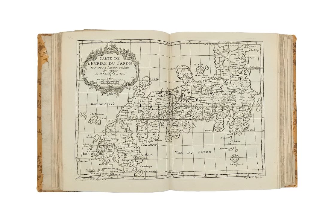
A collection of seventy-four maps taken from Antoine-François Prévost’s twenty-volume Histoire générale des voyages, the majority of them the work of the French cartographer, geographer and hydrographer Jacques-Nicolas Bellin.
Prévost, the French abbé best known for his novel Manon Lescaut, began publishing the first volumes of this monumental set recounting the world’s great explorers in 1746. Initially, the first seven volumes were translated and adapted from John Green's A new general collection of voyages and travels (1745-47), with later volumes compiled by Prévost himself or by his successors. While volumes XVIII and XIX appeared in 1768 and 1770 respectively and featured new travels to Iceland, Greenland, Kamchatka, and the Arctic, the twentieth and final volume did not appear until 1789, although it did include new voyages by Cook, as well as those of Carteret, Wallis, and Bougainville. In total, the twenty-volume set featured more than 260 maps, of which seventy-four have been removed and collected in this present collection. Most of the maps are the work of Jacques-Nicolas Bellin, an encyclopédiste and Ingénieur hydrographe at the Dépôt des cartes et plans de la Marine, whose cartographic work was particularly valued for its functionality and accuracy rather than its decorative artistry.
In the present volume are included maps of the African coastline and the Red Sea from vol. I (quarto edition); the Canaries, Borneo and Cape Verde from vol. II; the West Coast of Africa from vol. IV; southern Africa from vol. V; China from vol. VI; Tartary from vol. VII, southern India, the Maldives, Ceylon, and the Moluccas from vol. VIII; Siam from vol. IX; the Philippines, Indonesia, Japan, Mariana and the Makassar islands from volume X; the Straits of Magellan, Cape Horn, and the Juan Fernandez islands from vol. XI; Mexico from vol. XII; Paraguay and the Amazon from vol. XIII; Argentina, Guyana, Brazil, Florida, Louisana, Virginia, New England, Carolina, and Canada from vol. XIV; Haiti, Martinique, Guadeloupe, Grenada, Saint Lucia, Saint Kitts, Jamaica, Barbados, and various islands in the Arctic Sea from vol. XV; Siberia from volume XVIII; the Kuril islands from vol. XIX; and finally a number of maps from James Cook’s expeditions in the Pacific.